Page History
...
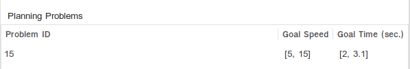
Additional information about the goal states are shown at the bottom of the Commonroad-Tab. Please note that goals are only drawn in the MapView if a position for the goal was set.
Lanelet Information
Additional information about the lanelets are shown below the goal information. The lanelet IDs can be toggled to know which lanelet the information belongs to.
...
ID (ID of the planning problem) - time when the goal should be reached (mean), v speed within the goal (mean)
Color Code for Obstacles
| Color | Meaning |
|---|---|
| Filled Orange | Dynamic obstacle with exact position |
| Filled Violet | Dynamic obstacle with inexact position |
| Orange Border, not filled | Non-Dynamic obstacle (static or environment) with exact position |
| Violet Border, not filled | Non-Dynamic obstacle (static or environment) with inexact position |
Lanelet Orientation Arrows
| Arrowhead | Meaning |
|---|---|
| Arrow / Triangle | Gives the lanelet orientation. No user is allowed to use the lanelet in the other direction. |
| Circle / Point | At least one user is allowed to use the lanelet in both directions. The Lanelet information table, given the ID of the Lanelet (if shown, which can be toggled), shows which user is allowed to use the lanelet in both directions (e.g. a bicycle). |
Lanelet Border Colors
| Color | Meaning |
|---|---|
| Blue | Lanelets are adjacent and have the same driving direction → Crossing this line should be allowed |
| Black | All other lanelets |
| Light grey | Lanelets for which no_marking was defined. Is overwritten by blue in case of adjacency to another lanelet. |
| Info | ||
|---|---|---|
| ||
The Lanelet Border Style can be defined in the Commonroad file (e.g. dashed or broad). Unknown and no_marking are not easy to draw. Thus, unknown is drawn like any solid line, and no_marking is drawn in a transparent grey color. Both colors can be overwritten by blue in case of adjacency (this information is more important). |
...
Overview
Content Tools